|
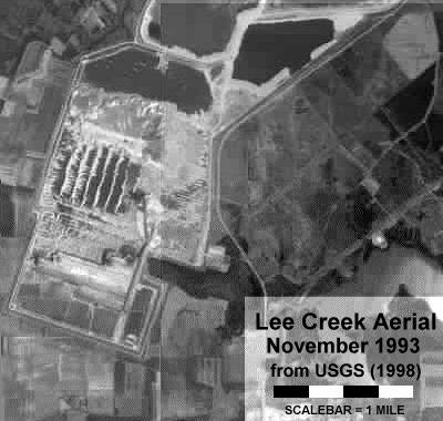
Back in 1999 I needed a satellite image of the then TGA mine for a paper; at the time dated versions were provided on line from the USGS. Recently I came across a version from Google (select satellite and double click to zoom in) and another (more up to date but still free) from MapQuest. (Microsoft's pay for view TerraServer was not used.) Thinking it a useful reference for the website, I asked Pat Young to add some relevant details to this image. It gives a good overview of the collecting areas past and present, putting terms such as NCPC and Block 26 into perspective. I also added the earlier image which provided a snapshot of the NCPC area at the time.
Tex Gilmore (PCS - Chief Geologist) subsequently reviewed the 'before' image and said it actually dated to November 1993! In addition, he noted the tract identifications we incorporated on the map were incorrect. The below image has been corrected and expanded. To put this into perspective, TGA (at the time) prestripped Block 20 in 1989-90 and mined it in 1990-91. I guess it can be said that the 2007 season is a return to the 'good old days'.
 |
| |
 |
| Satellite image showing Block 22 & 23 tailings. |
|